This is my account of hiking in the Knoydart Penisula from Inverie to the Sourlies Bothy and the slight disaster hike it became. There was obviously lots more arguing, more yelped worries and genuine panic (from me at least anyways) than mentioned, but just use your imagination. I’ve had several disastrous hikes, been lost in wilderness-type areas many times before, but this is probably the best one so far, seeing as I was accompanied by my wife, Bronwyn.
The Knoydart Penisula is on the North-East coast of Scotland, not far from the Isle of Skye and is considered the last wilderness in Britain – nowhere else in the UK can you hike for 2 or 3 days and not see anyone else nor be disturbed by any roads or cars. There’s no mobile signal either, no phone boxes, nothing 😀
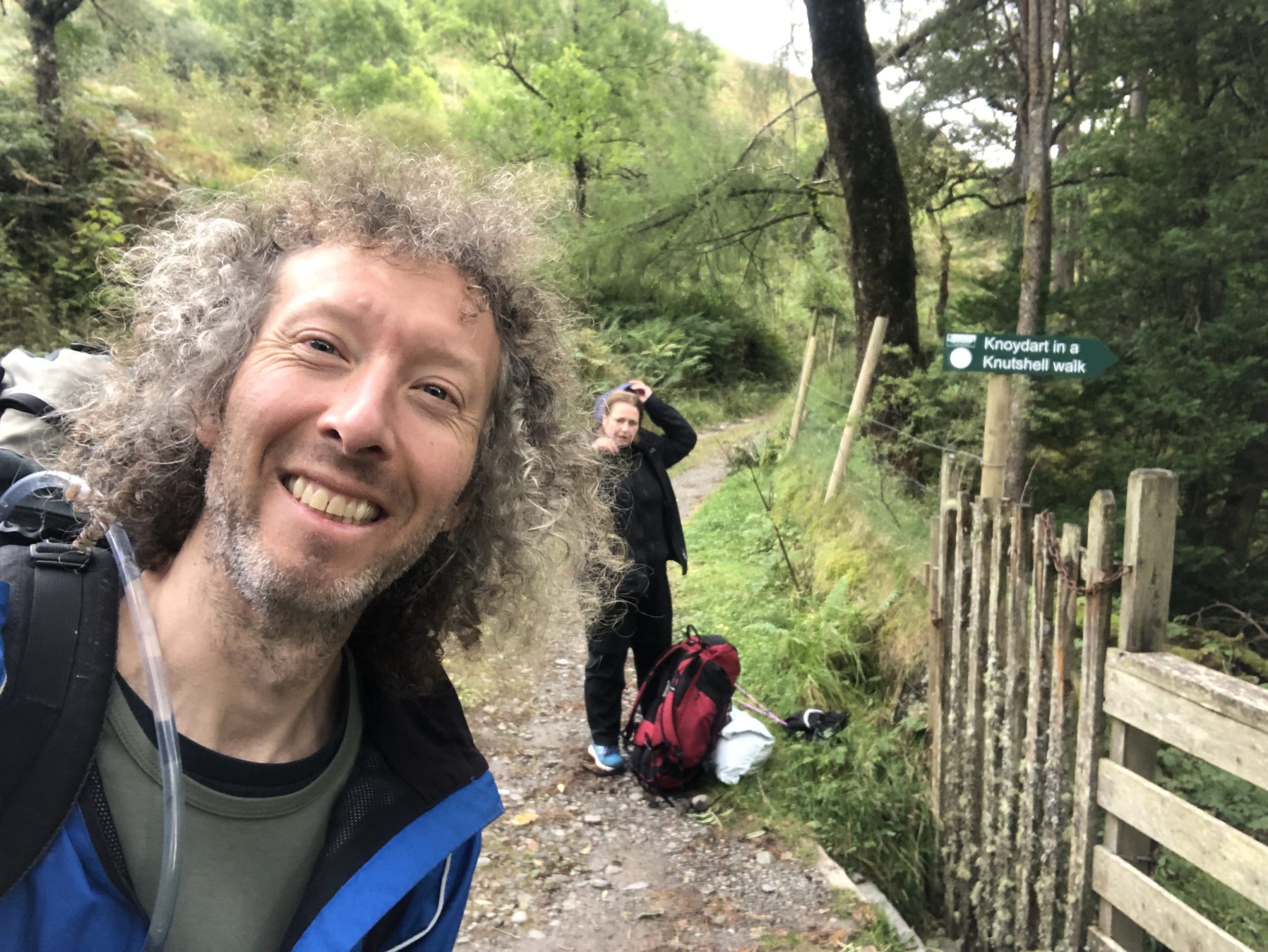
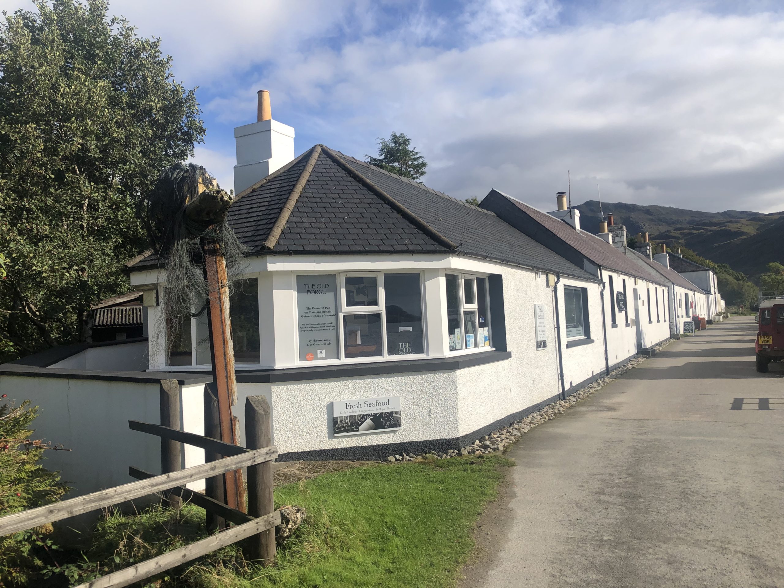
Access to the Knoydart is from a small village called Inverie, which you can only get to by hiking 27 miles cross-country or by taking a 45min ferry from the port of Mallaig. So why go to this place? Well, the original reason was the same as most visitors there – to see what is claimed to be Britain’s most remote pub “The Old Forge“. Having visited “The Nutshell“, the smallest pub in Britain, in Bury-St-Edmonds and various other unusual pubs, Bronwyn thought I’d like to see this one too.
Getting to the Knoydart Penisula and Inverie Village
The most popular way to get to Inverie is to hike the aforementioned 27 mile track – which runs from Glenfinnan railway station to Inverie – taking 2 or 3 days to do it. Glenfinnan is accessed via the Fort William <-> Mallaig railway line and most people park in Fort William and take the train to Glenfinnan to start the hike…BUT we decided to do it the other way round, because…I had just run the Loch Ness Marathon the day before! 😀 Yes, well time was short and whilst many “normal” people might want to take it easy after running a marathon, that’s just not my style, pal. I worked out that in-theory by doing the hike “in reverse”, I could give my legs a day’s rest! Therefore, the proposed plan was to park at Mallaig, take the ferry from Mallaig to Inverie, have dinner at the pub, camp the night at the camp site, hike 6miles the first day to Sourlies Bothy, hike approx 9miles next day to In’Cha Bothy in the forest(or camp somewhere nearby) and get up bright n’early to cover 13miles the final day to Glenfinnan Railway Station, catching the 4:57pm train – back to Mallaig and the car.
So we drove from Loch Ness to Mallaig, parked in the Long Stay car park there and took the 2pm ferry. My legs were a bit tired after the marathon, but feeling better by the minute to be honest. It was a pleasant boat trip with a lot of very enthusiastic people – who even pointed out seeing a Gannet dive into the water to catch fish! most of these people were staying in the Wee Hooses(see below), although one guy had his bike and was camping.
Shortly after landing, we discovered Inverie is indeed a very small village – pretty much consisting of :
- A restaurant called The Look Out(which also has some lodging rooms collectively called “The Gathering”)
- A cafe that makes a good cup of tea
- The famous Old Forge pub
- “The Table”, which is located opposite the pub and was set up as an alternative somewhat bus-shelter-like-“pub” by locals who really dislike The Old Forge’s owner 😀
- A bunkhouse(which was annoyingly closed)
- A few rather expensive “Wee Hooses”(small houses) to stay in.
- and a Post Office where we purchased some food/supplies. Must mention, despite no mobile signal the locals kindly offer free wifi in a room next to the Post Office, so you can book your return ferry trip if needed 😀
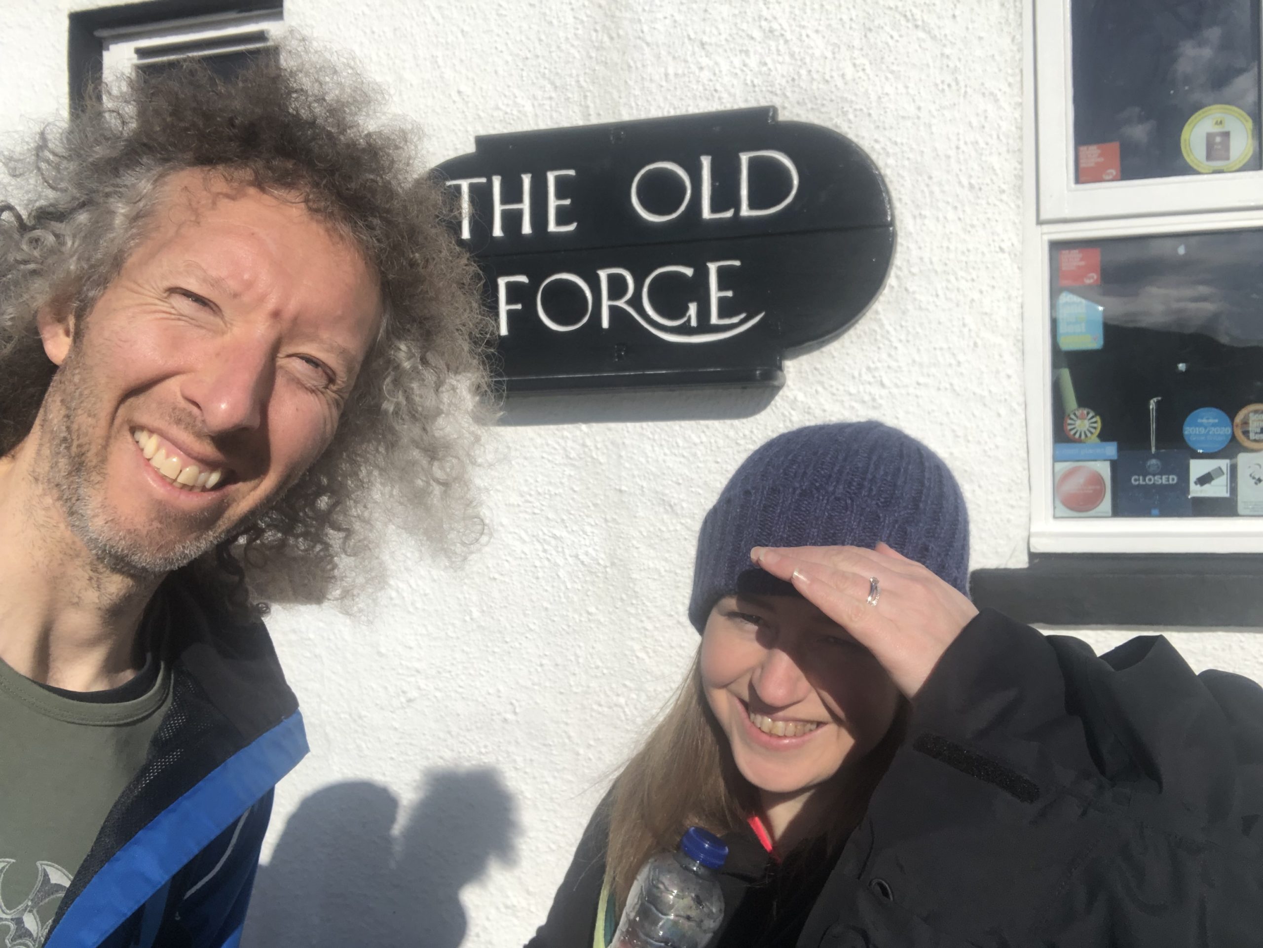
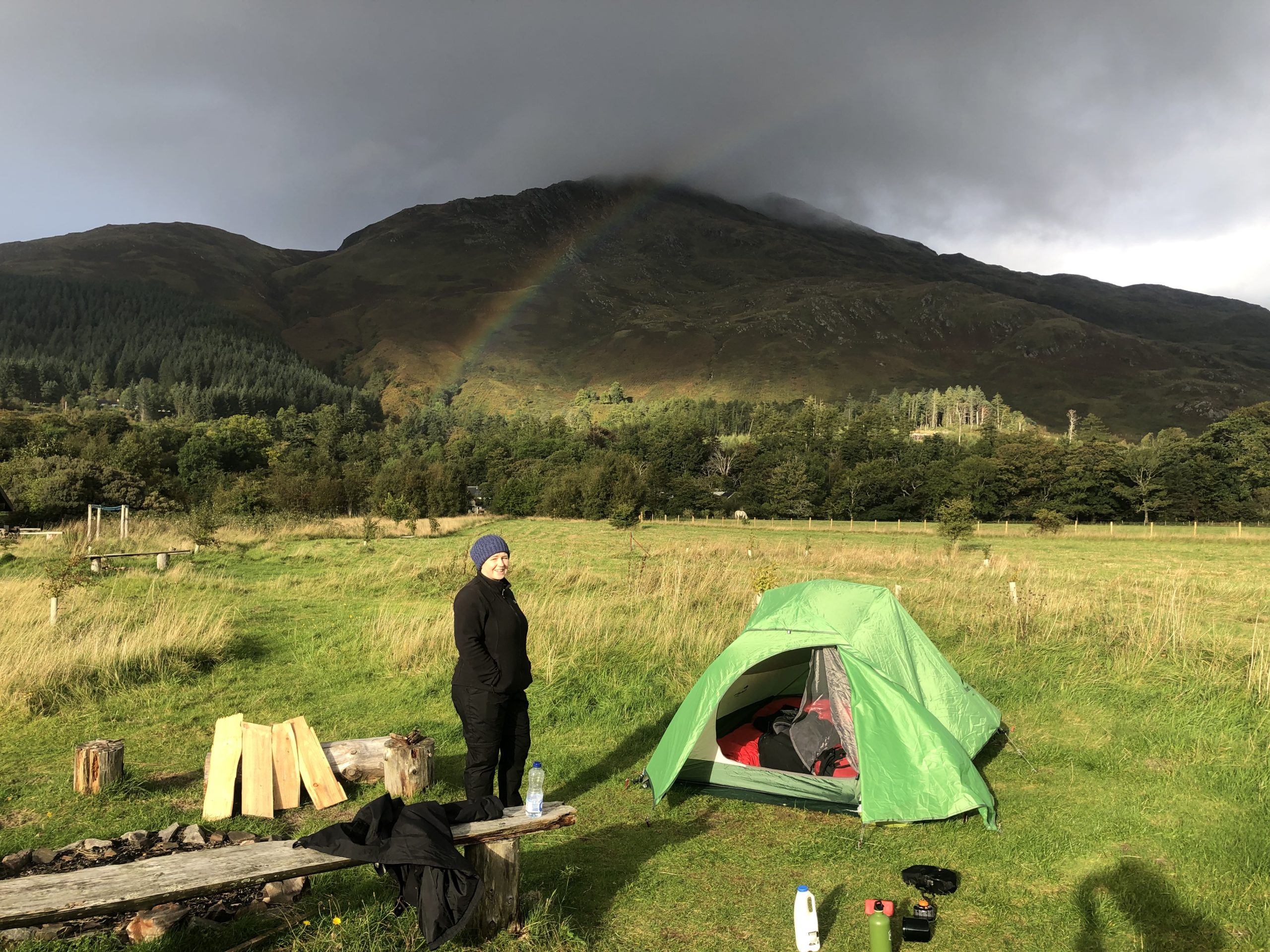
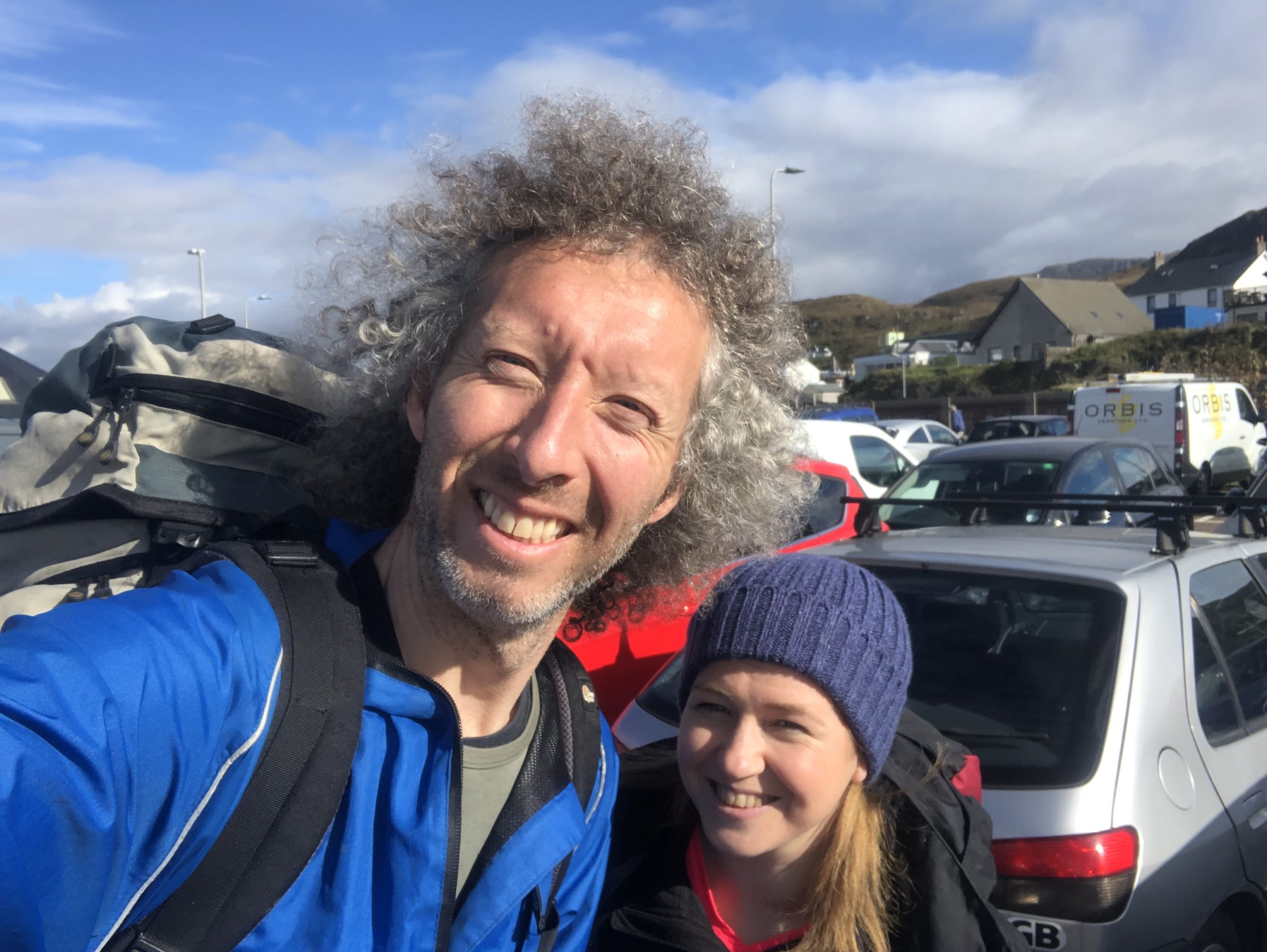
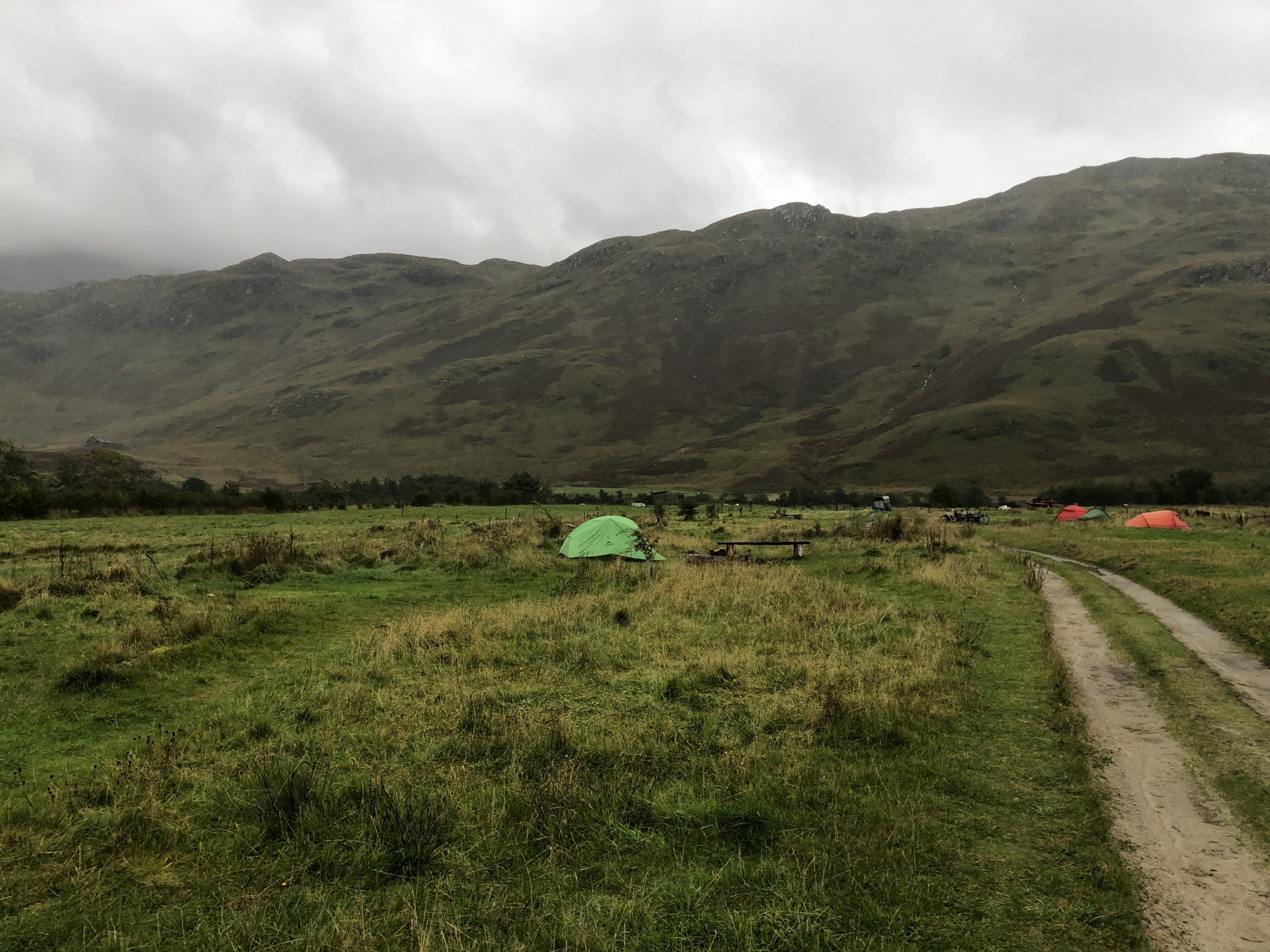
We lugged our backpacks the full mile to the camping site from the ferry port, stopping at the Old Forge to take a selfie and bought some supplies at the Post Office. We then set up camp in our new 3 man Naturehike Cloud-Up 3 tent.
After cooking some lunch at the campsite wooden hut and reading the advert in the hut offering accommodation in a Wee Hoose for only £150 for a night if you change your mind about camping, around 4pm we met two girls who had hiked from Glenfinnan over 3 days – they said they’d had Sourlies Bothy to themselves and only seen 2 people on the whole trek – to be honest they both looked shattered and their waterproof trousers were ripped to bits from river crossings apparently. They told us it was one tough trek, but they “kind of enjoyed” the last day, in that it was a relief compared to the rest. We told them our plans and they were quite shocked when I told them I’d just done the marathon 😀
The Disasters Had Already Begun
Now, to be honest, we had been hit 2 disasters already :
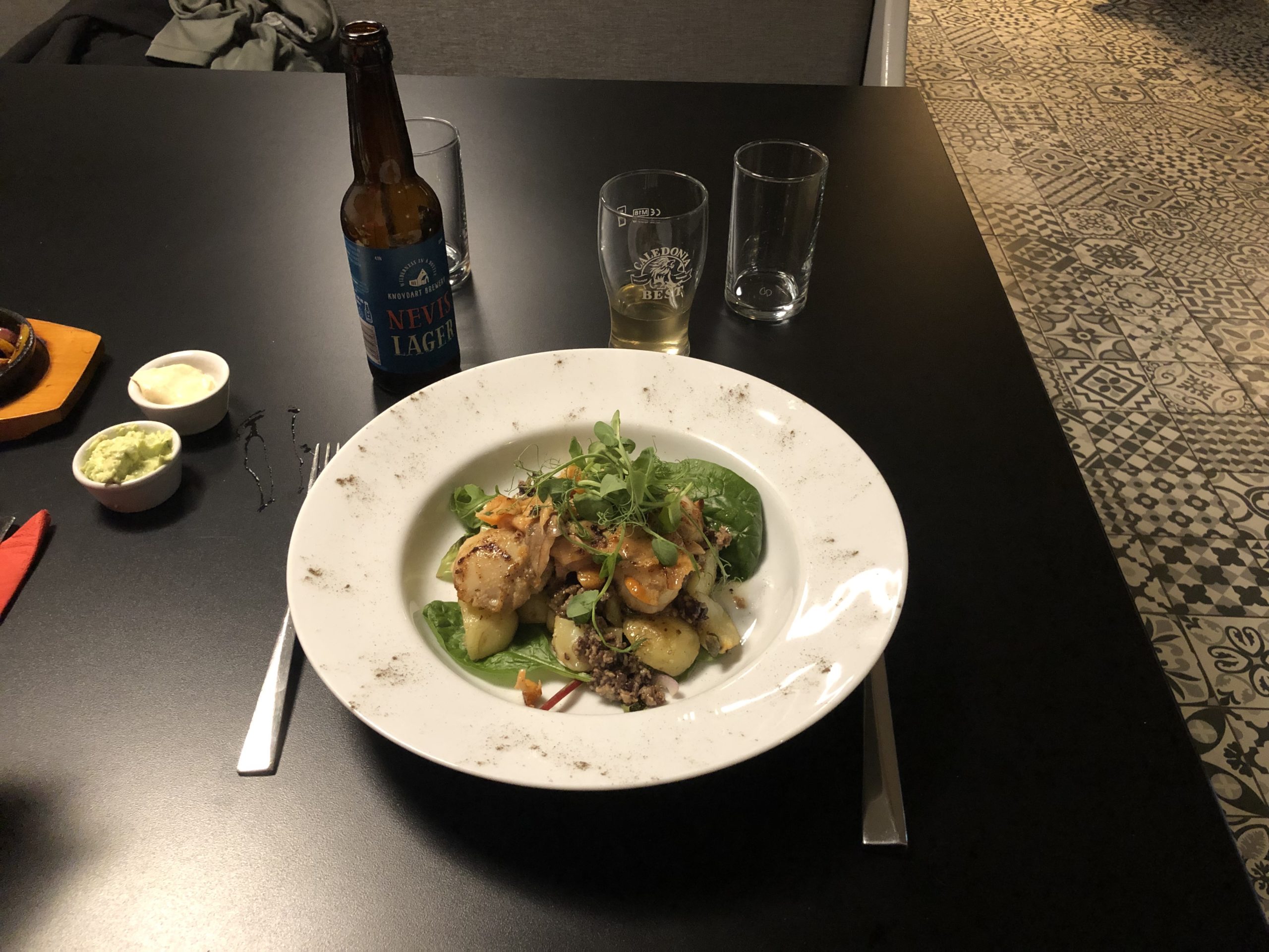
Disaster #1 was Bronwyn phoning the pub a few days before and being told the pub was closed – yep, the main original reason for going to this place was closed, hoorah! so this first evening instead we went to The Look Out restaurant instead, which does remarkably good food – best scallops and haggis ever had anyway. On another table we saw the girls we’d met earlier and later one of the waitresses enquired “oh are you the guy who ran the marathon?!”, news travels quick round this area.
Disaster #2 was the weather forecast – nice days on Tues and Wed for hiking, but heavy rain from Wed evening and all day Thursday. This majorly altered our plans! Neither of us felt like trekking 13miles with full backpacks in heavy rain – simple as that – the weight of the tent and 3 days of food also seemed quite excessive to me(note to self: must learn to pack lighter).
So…the new plan became that we’d leave our tent where it was(along with anything we didn’t need) hike to Sourlies Bothy, stay the night and hike back, simples!
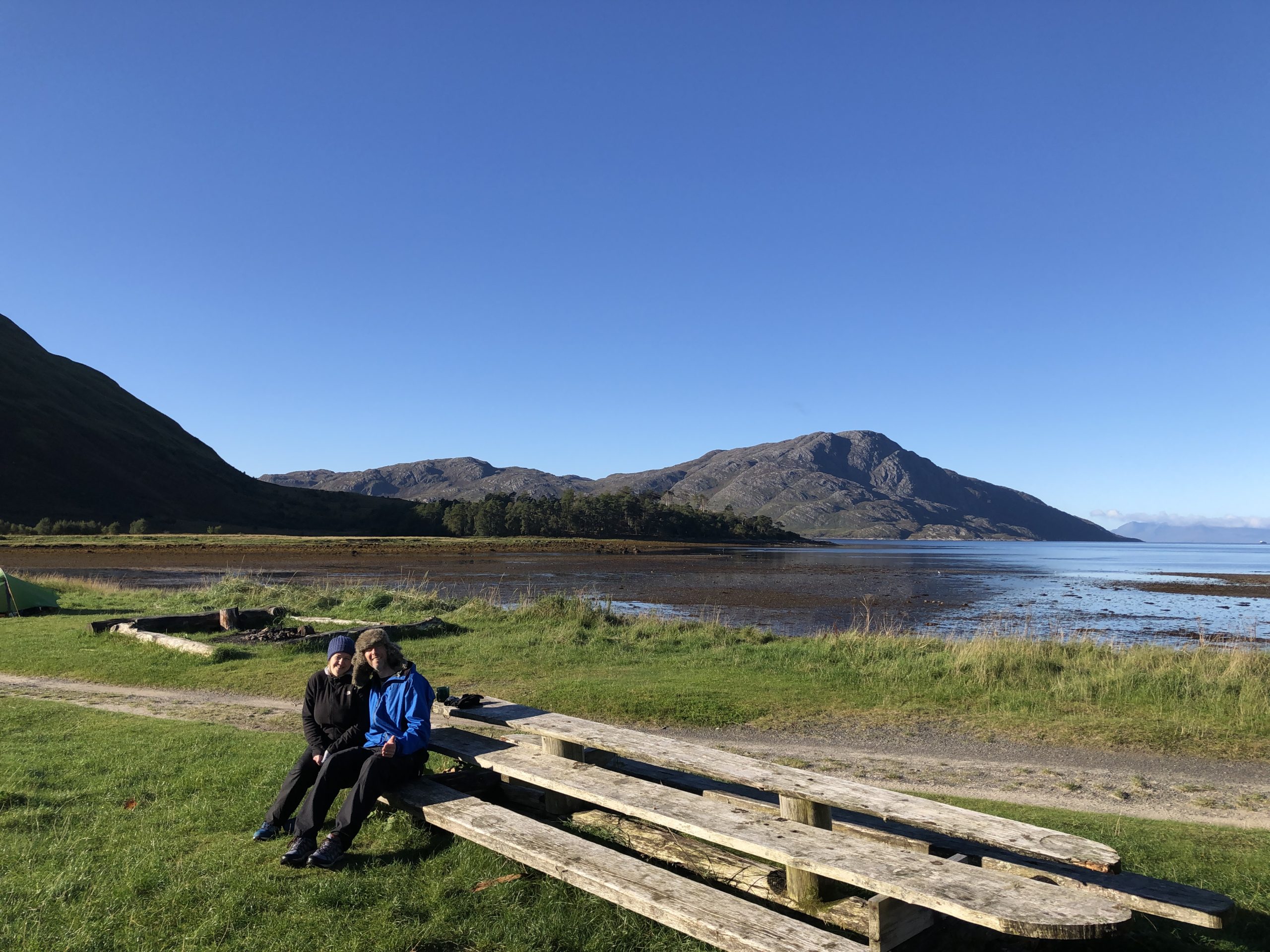
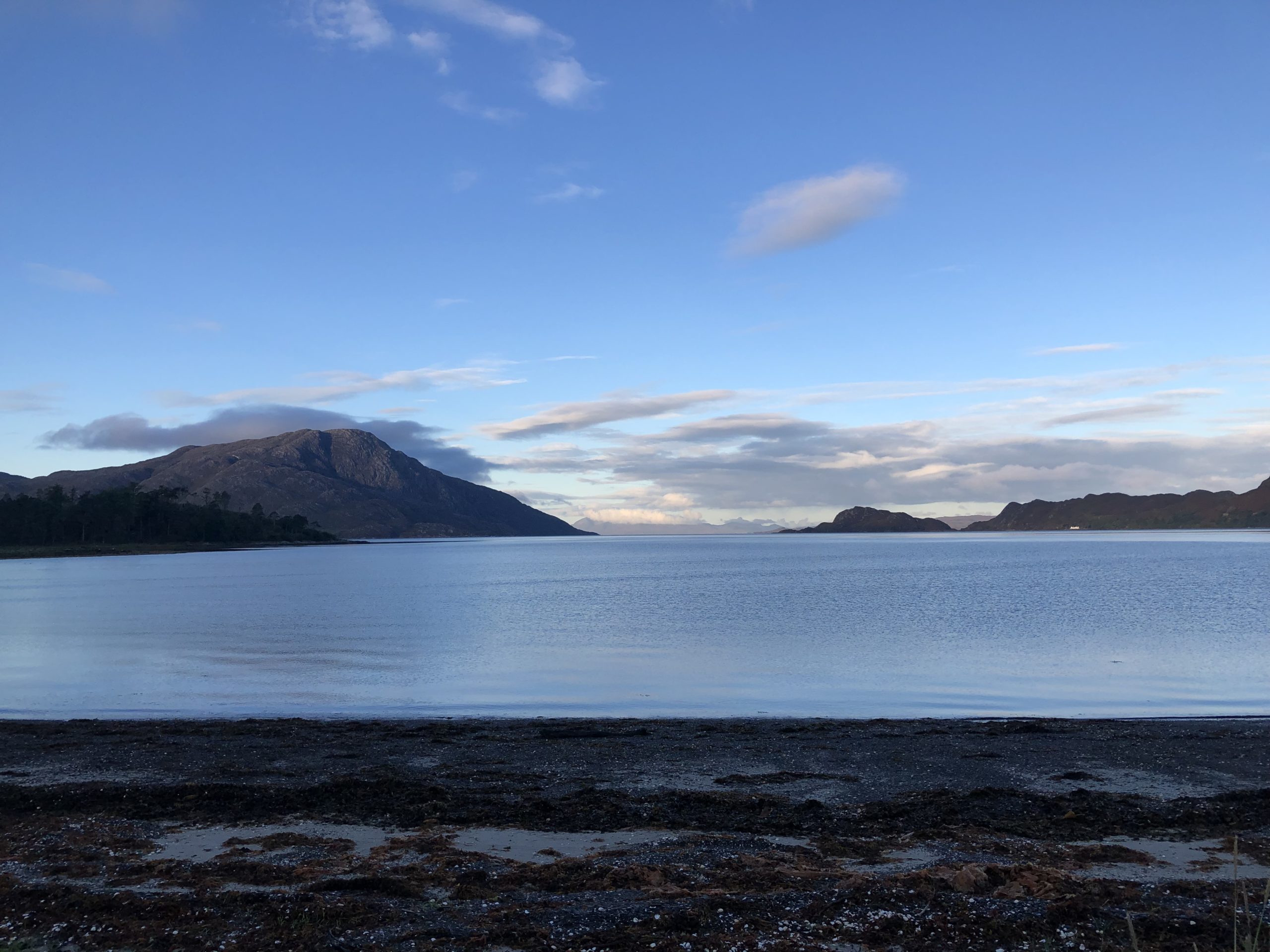
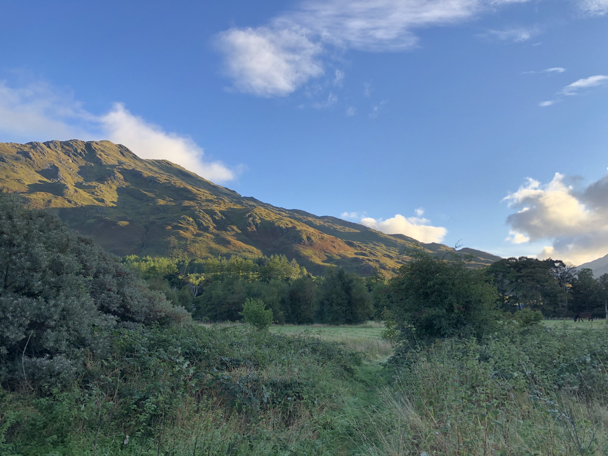
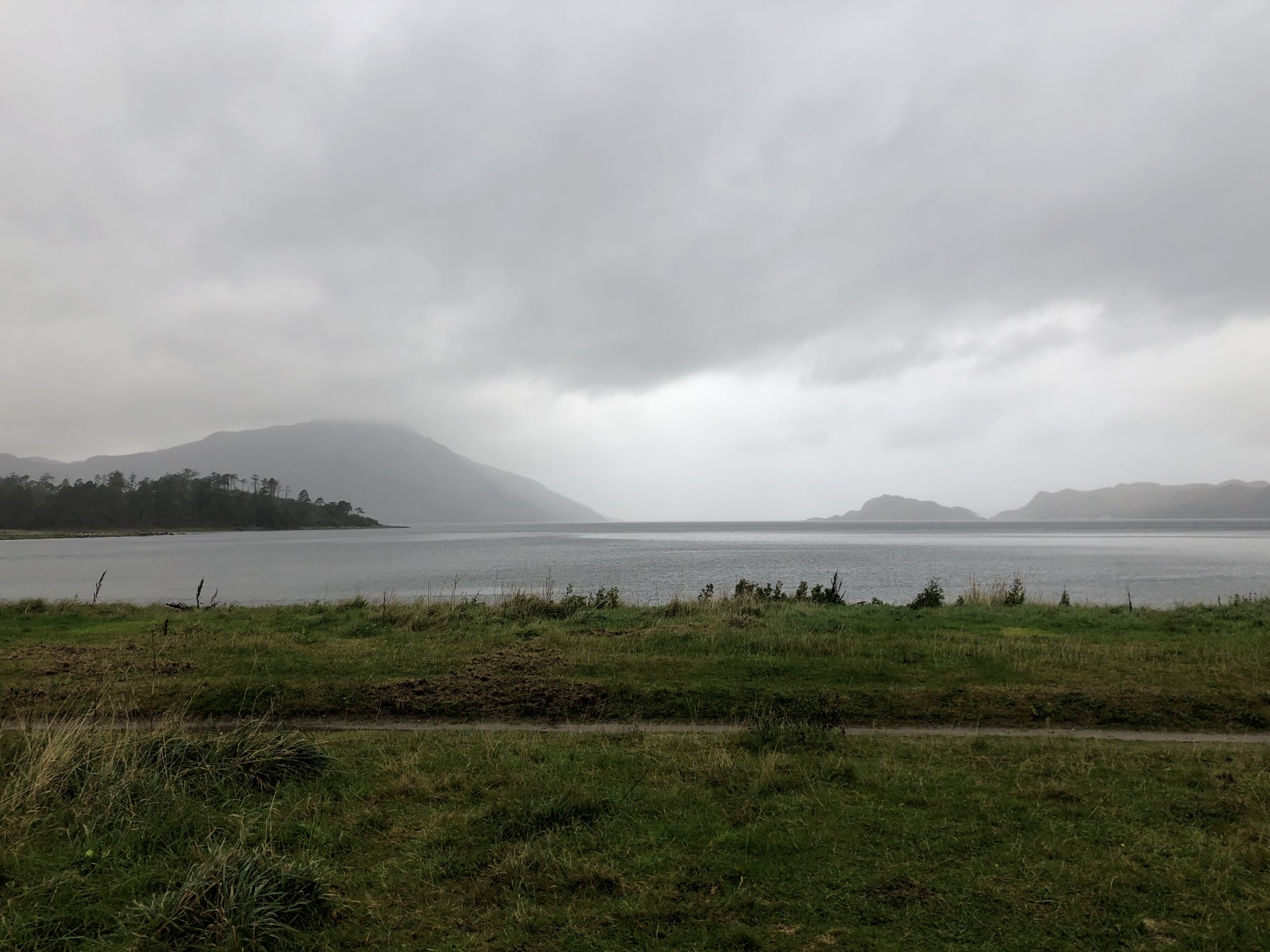
Next morning, despite it being bright from 7am, we got up around 8:30am and sat with a tea & coffee admiring the spectacular morning view – the sun rising, the estuary, numerous birds wading in the water, the mountains as a back drop, the quietness, just wonderful.
Disaster #3 – We left at 1pm
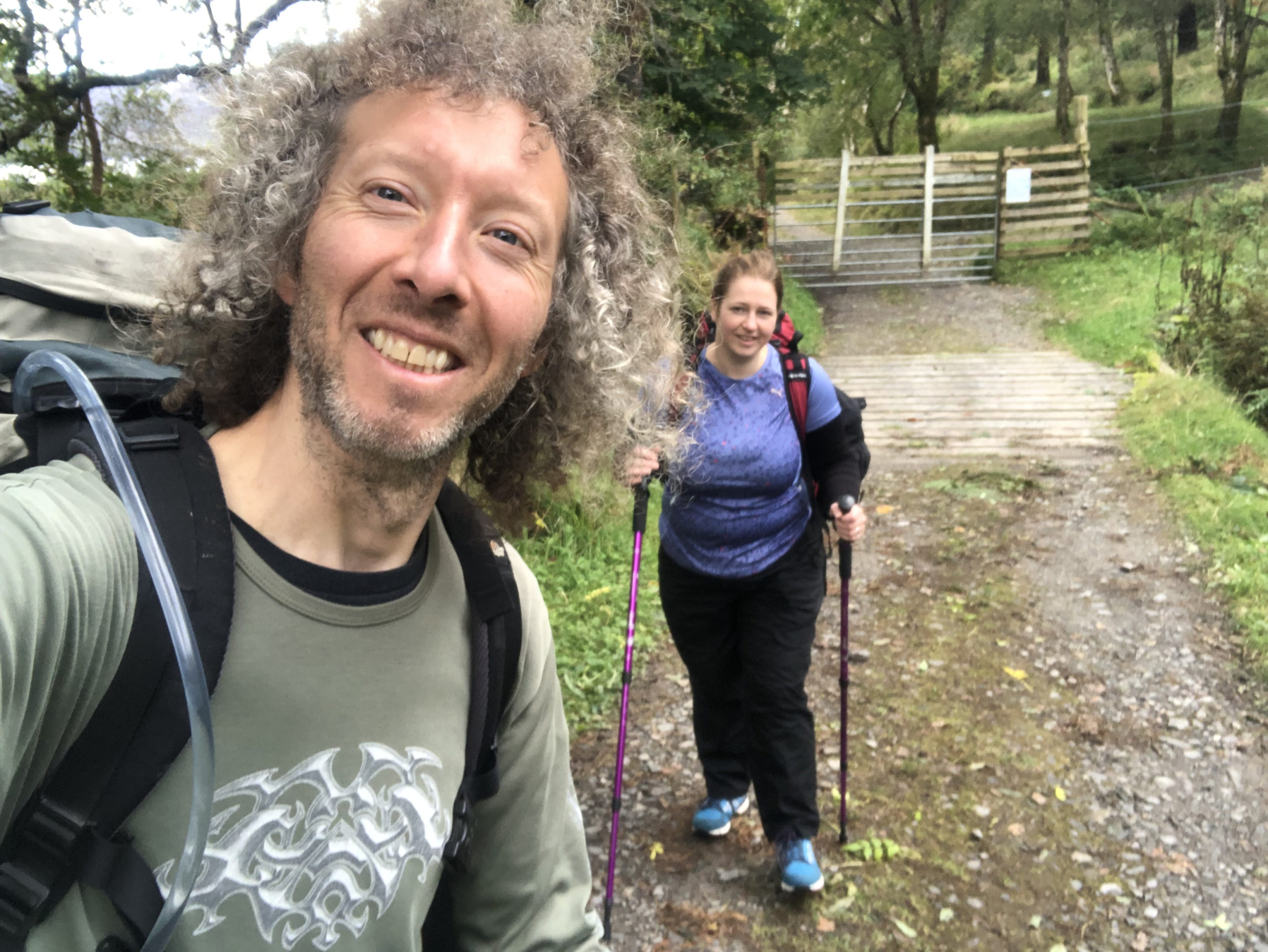
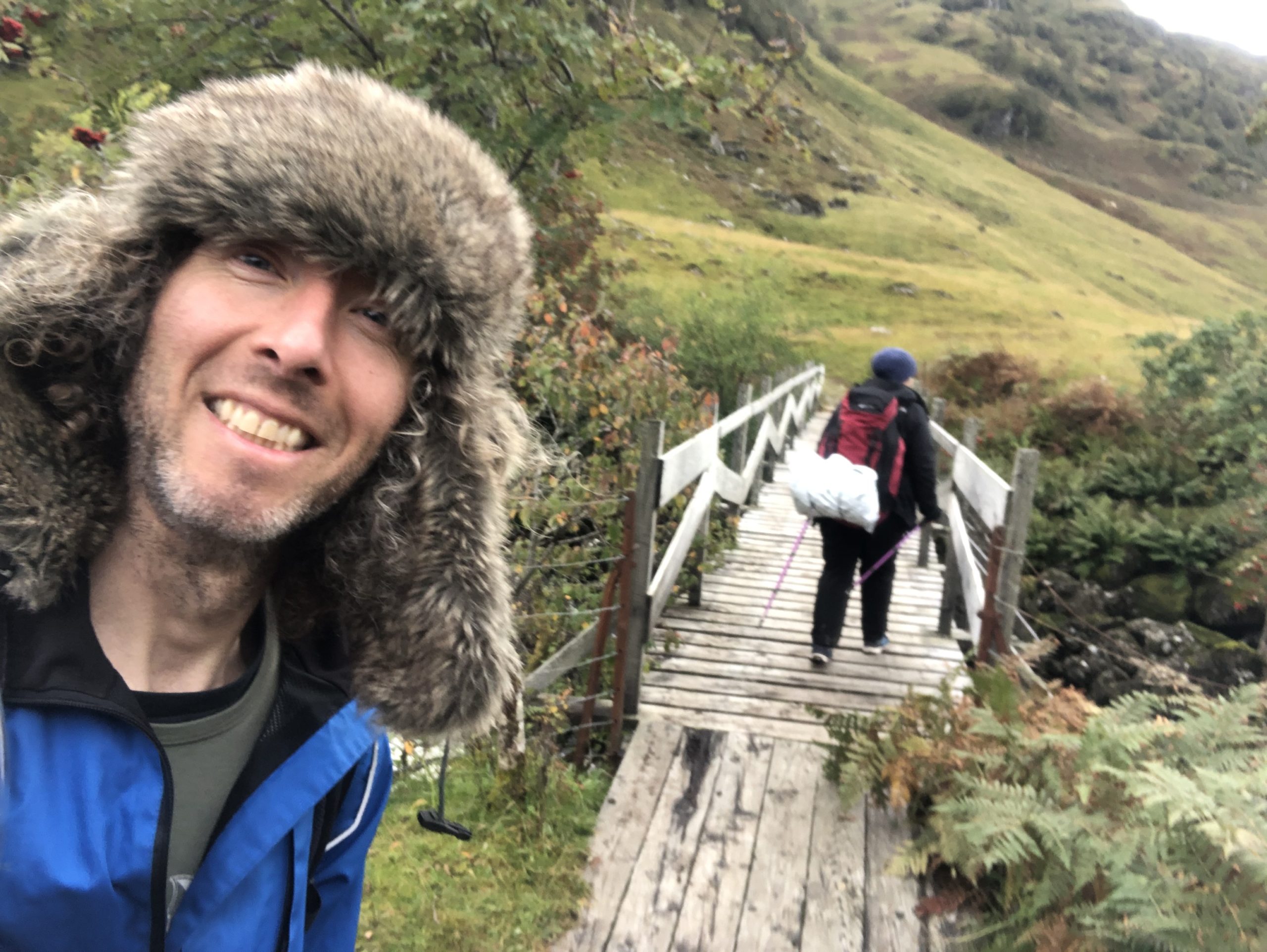
We re-packed our backpacks with sleeping bags, sleeping mats, torches, food for 3 meals each, cooking equipment, warm clothes for the night, water etc. This seemed to take an inordinate amount of time for some unknown reason(probably due to faffing). Should say we were quite well prepared for this hike – I had a printed map of the route I’d grabbed off Google Maps, the offical Knoydart O.S. Map, notes copied from The Scottish Bothy Bible and we even had walking poles – on the board-walk out of the campsite I managed to delay us by 20minutes by losing the rubber end-cap of one of my poles, so that didn’t help. Anyways, Thus our adventure begun – at 1pm!
I still thought 1pm would be fine as various blogs I’d read AND The Scottish Bothy Bible claimed it was only a 10km or 6mile hike – that would take 4-5 hours – I guessed this would be more like 6 or 7 hours with backpacks, so we’d arrive just after dark around 7:30pm – no need to worry Bronwyn that they said it was a “technical route” either, as in my experience that usually just means you have to walk up a mountain path and clamber over a few rocks.
So we set off and all was well and good! We were a bit confused where the trail actually started so asked a local lady the way and she told us “follow that path, go past the barn, up the hill, take the right path and just keep going and…just keep going!”(she gave a foreboding and hearty laugh after this, I now realise she was probably amused we were attempting this after 1pm).
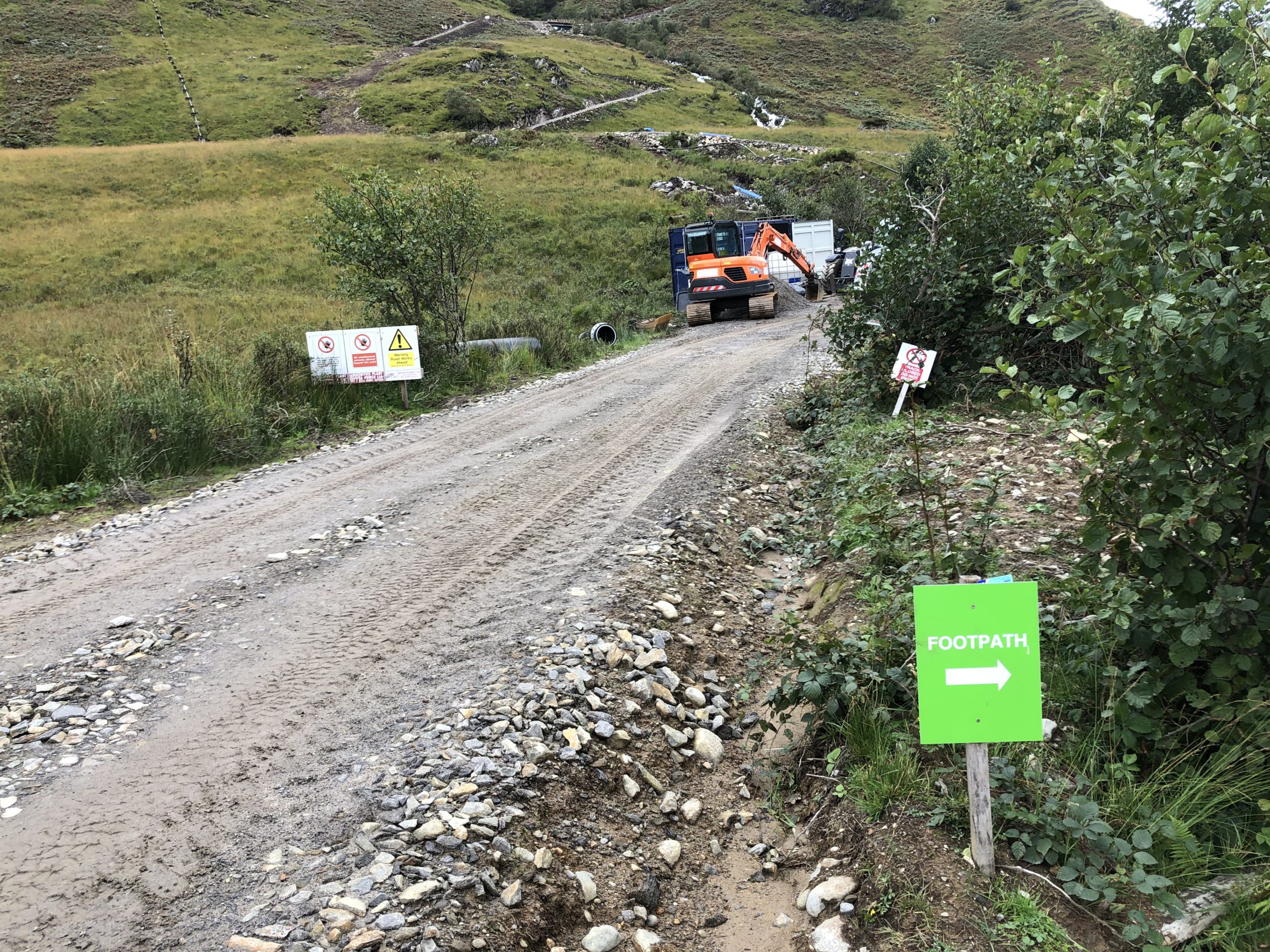
We followed the road and found the barn, which led to a steep, thickly wooded area bordered by some kind of waterfall. The steps up hill were quite hazardous due to being mossy and wet, but no problem really, as long as you took your time. After this we found the way to be generally a paved or marked/obvious path. Now, apart from losing the trail half a mile beyond the wood, by taking a wrong turn and ending up on a building site – where we were told by a friendly workman that his boss might yell at us to “get lost”, things were good. Unfortunately, it looks like they’re building a road up and over the Inverie Hill – probably as a shortcut for traffic, which could well be a huge shame.
A Private Bothy and a Dead Deer
Continuing on, we made good progress and got to a “private bothy”. It was all locked up and there were lots of signs saying “Private” adorning it. The big Kilchoan estate borders the trail and I assume they use this bothy for various guests/visitors. Suddenly a guy driving a quad bike drove past carrying a huge dead stag on the back. He hailed me with “Alright man!”, which was nice. A few minutes further down the path we passed two very well dressed gentlemen(whom one suspects had shot the aforementioned stag). These three were the only people we saw the rest of the day.
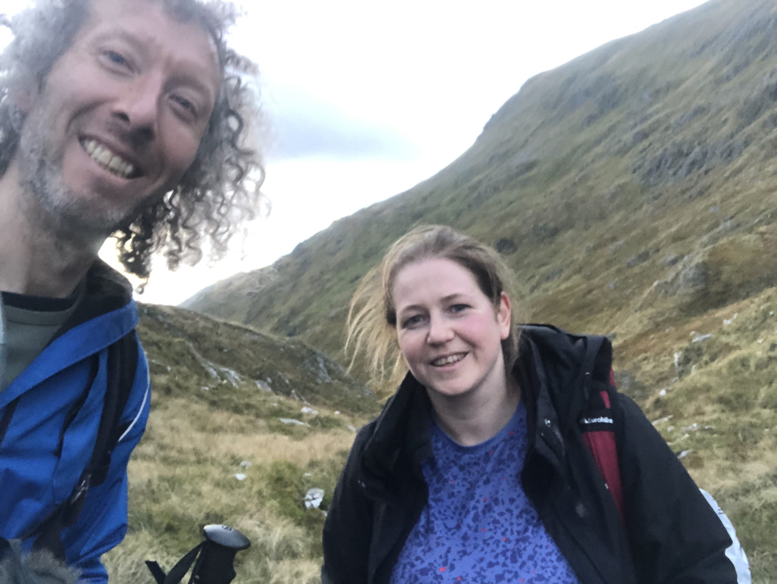
We carried on and the trail began to veer upwards and onto a mountain path. The path was rocky, very damp and often streams of water would be dripping towards us from up-mountain. It wasn’t particularly difficult hiking, just quite slow going and our walking poles proved a most helpful addition it has to be said on such terrain.
The Concern Begins
I’d noticed on the map we were meant to ascend to around 500metres and seemed to be going up remarkably slowly. What seemed like miles and hours later, in fact it was around 4pm I believe, we checked the map to see what progress we’d made and where we were. Bronwyn worked out where we were(as I can barely read an OS map) and have to say I was somewhat dismayed to find we were less than half way along the route! I kept that dismay to myself and we trudged on. The path got steeper and steeper.
I casually asked if Bronwyn had seen the ruins mentioned in the Bothy Bible, but there’d been no sign of them.
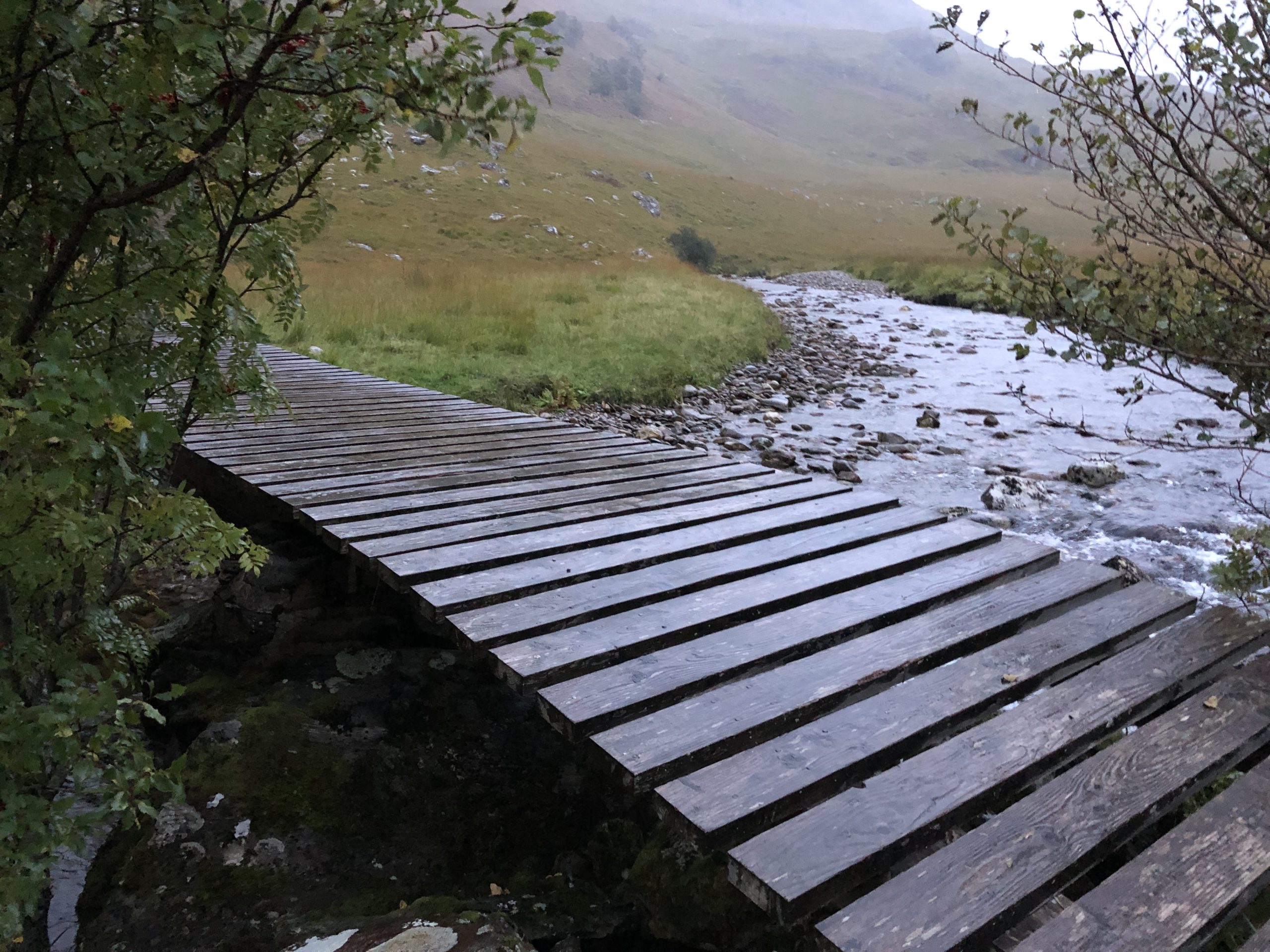
Towards the summit(Mam Meadall on the map), we came across several river crossings. Lumbering a full backpack made crossing them more “challenging” than usual, but you just needed to take your time balancing on necessary rocks. Then we met one that was far too wide to jump, very fast flowing and without any helpful boulders. Also it was so close to the sheer cliff edge, any mistake or mis-step and you would highly likely find yourself plummeting off-mountain, ultimately to be dashed on rocks 50 metres below. I don’t say this lightly and ended up having to remove my backpack, stand in the river, lean against the tide and help both backpacks + Bronwyn across. There was also a fine rotten wooden bridge that was also somewhat concerning, but fine once you crossed it. The path continued ascending.
We’d Better Hurry Up Before It Gets Dark!
Around 5:30pm I announced we must push on and up the pace somewhat, the reason being was to urgently get to the summit by sunset at 6:30pm! once there it would be a case of descending steeply downwards, crossing the wetlands for half a mile and then we’d be at the bothy, probably just as it got fully dark.
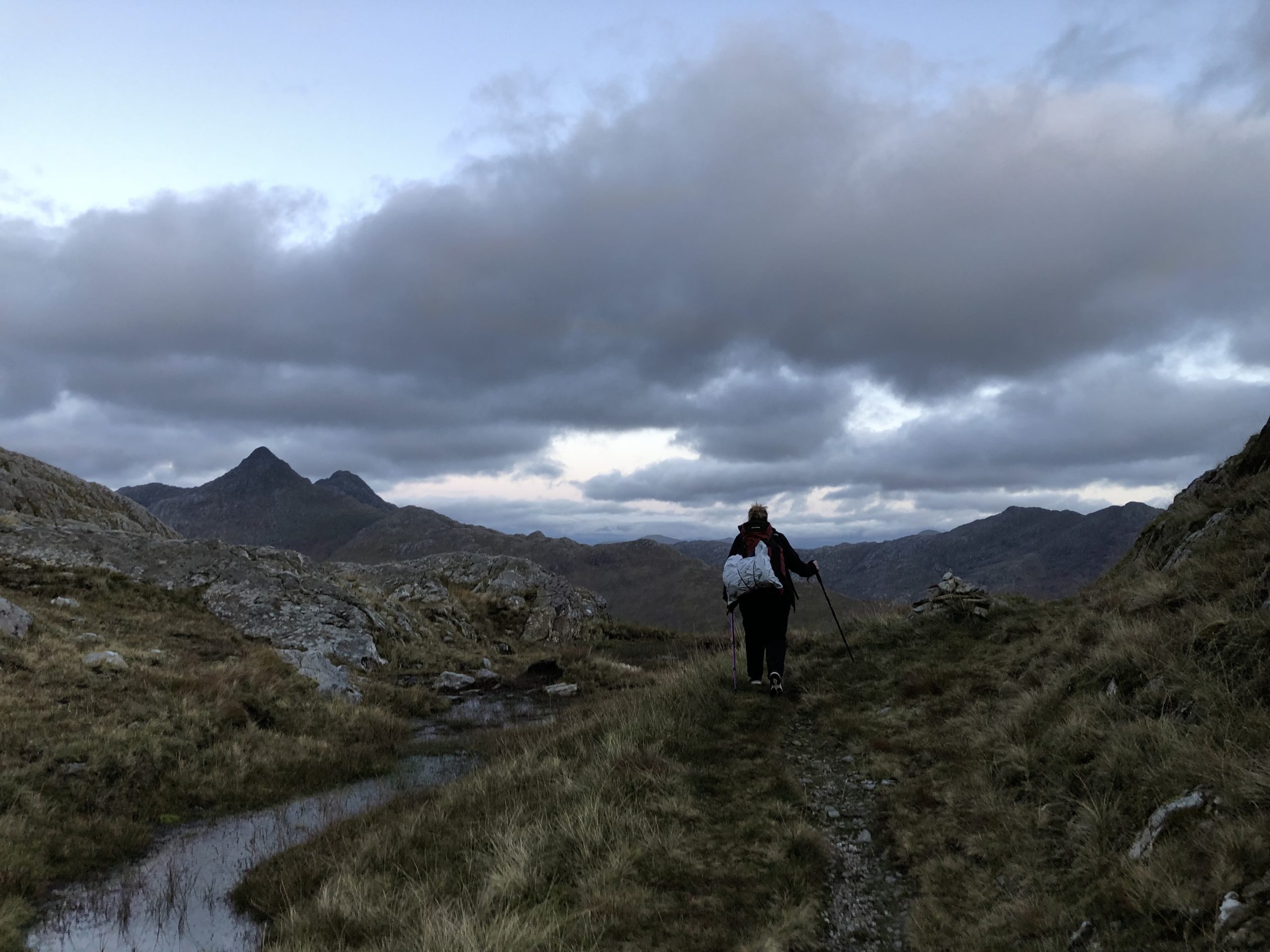
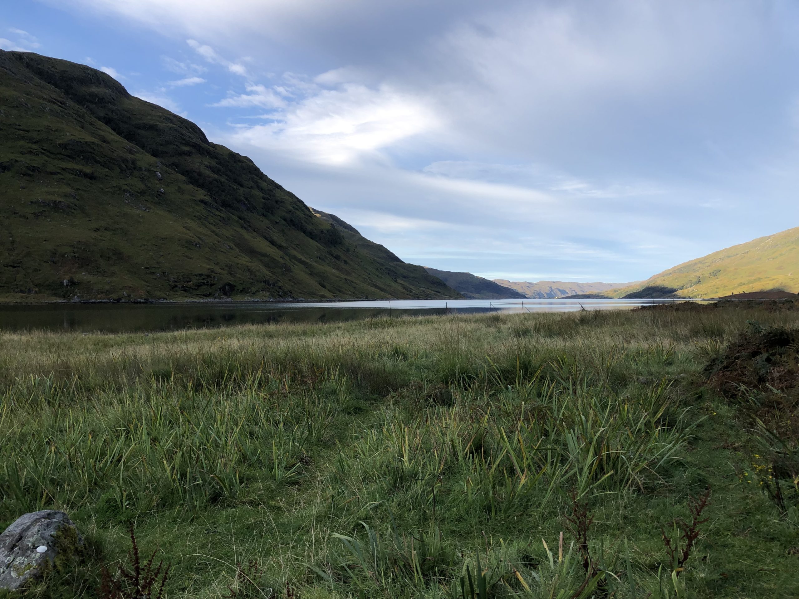
We got to the summit at 6:30pm exactly! just in time to see the sun go down. It was quite beautiful. We had a break for 10mins and then set off down the alleged “zig zag path”. We could see a valley area below us, with a loch in the distance(where the beach is according to the Bothy Bible) and a large river snaking its way North-East. The zig zags didn’t start for quite a while, but the darkness did. By 7pm we had to dig out the head-torch just to see the path – Bronwyn in front of me wearing it and I following as best I could without tripping over. As dusk grew darker, the path became furrowed and full of rocks, that made it really fun to navigate in 2nd-hand torch-light. Still, at least we were moving quicker than going up-mountain, but the thing was this track took ages! It went on for miles! it didn’t go straight down, like a regular mountain path, it took us left and right and around the mountain! As time ticked by and we moved along the path, you could see the meanders of the river below us disappearing into the darkness and I became quite concerned we wouldn’t have any actual reference points to where we were. At one point we wondered if we were on the right path and considered turning back, but that wasn’t really an option, as at least it was descending, albeit incredibly slowly.
The Ruins At Last
Eventually, we got to ground level in near-pitch-darkness, it was then we saw the ruins at last! You really don’t know the sheer relief of seeing these ruins, meaning we were on the right path! According to the fabled Bothy Bible book text and O.S. map, a bit further on we would find a bridge crossing the river, then “a half mile of wetlands and then a short walk to the bothy”. My elation at seeing the ruins abruptly stopped when abruptly the path ceased to exist or rather became over-run by overly long torso-height grass! Our only choice became to head roughly East, skirting the ruins as best we could. This all sounds very trivial, but visibility was net zero other than what Bronwyn’s head torch lit up.
The Bridge “At Last”
We then heard running water in the near distance and proceeded further ahead, discovering the bridge or “The bridge, at last!” as I cried – the Bothy book had described this as a wire bridge and I’d been asking Bronwyn where this was since the top of the mountain path. It’s clearly been upgraded since then and is quite a sturdy regular metal and wooden bridge, thank goodness, as crossing a precarious wire bridge in the dark would not have been fun. After crossing, once again the path disappeared into what looked like a line of trees, bushes and plants that would be very difficult to traverse safely in the dark. Consulting the map, we decided instead to venture along the path by the river. In theory, this would be a longer walk, but we just needed to follow it as far as the beach by the loch edge, follow that for a mile or so East and hey presto we’d be at the bothy. Essentially this route was taking the two sides of the triangle, rather than the hypotenuse of it.
We walked along the river for what seemed like miles! for ages we trekked along the path as the river meandered randomly, the path then disappeared once again and the river veered West which it certainly shouldn’t do according to the map. At this point I started to complain and be most concerned that this was way too far to have walked and we were clearly lost. Continuing on, even more strangely the terrain became more and more swamp-like. We had to cross deep pits of earth and reeds, which you often couldn’t help but fall into due to the lack of light. We’re talking pits up to a metre deep here and this was where my socks finally got properly socked! even my brilliant brand new waterproof Colombia hiking shoes could not take being fully submerged like this. Should be said I was somewhat afraid of falling into one of these pits and injuring myself, I wondered how I’d be carried out of there or would it be like Joe Simpson in “Touching the Void” where he had to haul himself miles back to base camp. It also struck me that this area may well be some kind of in-between-the-tide-land and as my fear exasperated that the tide may return, trapping us, so did my desire increase to leave as soon as possible. Couple that with the utter confusion as to where we were, I would say my concern that we were staying the night out here in the elements reached its peak at this point. There was also concern that Bronwyn would(perhaps sensibly) never go hiking with me ever again and her parents/relative would probably tell me off too, oh well.
Looks like we’ll be staying the night Al Fresco
So with that pinnacle of anxiety, I think it was at this point that I had to make a call and prepare Bronwyn for the distinct possibility that we would have to spend the night out in this desolate wilderness…not in a bothy…but in our sleeping bags on the cold, soaking ground. I wanted to formally address this issue now as insurance against mentioning it in 3 hours time when true tiredness and abject panic had set in. Other women would have been rather upset at this announcement, I don’t doubt their screaming at me would’ve echoed around the surrounding mounting, possibly alerting the rescue services and ironically saving us, but I think Bronwyn appreciated my honesty and accepted the situation better than most 😀
The wonder of the GPS tracker
We stumbled onwards, managing to find the most grassy area we could and desperately consulted the map once again. We re-read what the Bothy book said and even checked my GPS tracker which displayed the zig-zag random route we had so far walked. Please note: my GPS tracker only showed the route we had walked, there was no downloaded map with placenames or even the shape of the area on it or anything sensible like that, no, none of that stuff normal hikers may have! 😀
Bronwyn briefly mentioned turning back, which I knew was not an option, we had walked far too far in random directions to know where else to go, let alone to get back to the ruins.
We tried to compare the GPS track with the OS map, but to not much avail. Even better, walking a few minutes further North we came across a huge white rock face in front of us – when all logic and the map pointed to there only being open water! We routed East once again and found a shallow river in front of us. We had no choice but to cross it and luckily it wasn’t too deep, but we were all the more confused by this. The terrain now was mostly just flat mossy bogland. Bronwyn consulted the maps and GPS tracker yet again and came to the conclusion that we must have backtracked on ourselves when following the river and gone far enough East to hit the small rivers shown on the map.
It was here we decided that the best thing to do was simply to head East and eventually no matter where we were, according to the map, we’d reach the mountains. Credit to Bronwyn here as her map reading skills are way better than mine. At least on some higher ground it may be a bit drier, instead of the soaking bogland that this was and we could stay the night there, until daylight around 5am. I used my iPhone compass to head directly East, sticking to that direction as best possible, although several times I had to correct us, as we drifted off due to the mossy ground, bushes, grass and pools of water – some that were just too thick or deep water to traverse in a straight line.
To improve the level of fun, the head torch now began to fade. Fortunately, I’d started sparingly using our other hand-held torch and had prepared a USB charger pack in case of emergency. So, we were only without light from the head-torch for a few minutes.
I see people! Oh noooo!
Next we happened upon some long knee-high grass. Suddenly, Bronwyn said in an excited voice “Is that people?! I can see eyes reflecting!“, “Hello!” she hopefully cried, shining the head-torch into the far distance. “Hello! Can you help us?! We’re lost!“. I joined in “Hello there! are we far from the bothy?“. Silence. Sadly there was nobody out there, just some deer. This was very disappointing, a cruel glimmer of hope given, only to be snatched away.
By now I’d gotten to thinking “You know what, it wouldn’t be so bad. We would be alright as we had sleeping mats and most importantly of all it wasn’t too cold nor raining”. The only problem would be finding dry ground. I once vocally again informed the world of all this, but neither the deer nor Bronwyn seemed to mind.
Out of nowhere a miraculous path appeared
We proceed through the long grass and randomly happened upon a miraculous sight – out of nowhere, a path, a real well-trodden path appeared! like what we hadn’t seen for the last 2 hours!! Bronwyn checked the map once again. I got very excited by this and checking the compass I noticed it was leading roughly South-East, so this must be the path we’d been looking for originally! The very fact it was heading at least South seemed extremely good news to me. Understandably, Bronwyn was skeptical at first, something about it not being anywhere near any mountains, probably due to the number of wrong turns we’d previously made, but I persisted following this wonderful path. After about 5minutes, glancing left, it could be seen that we were indeed near enough to see the outlines of a large mountain lightly highlighted by the sky – our eyes must have adjusted well to the darkness. Then we came across a small path, which forked out left and lead up into the mountain. Bronwyn announced this must be the “side path that takes you on the scenic route to the bothy” as mentioned by the Bothy book. After passing it and deliberating a couple of times back and forth along it, we ended up climbing up the first few rocks and then, as seems to be the fashion in this area, noticed the path once again disappeared beyond some rocks! it was immediately decided that after being lost for 2 hours in the darkness, it would be insane to go off-path and try to navigate this alleged “scenic route” across a mountain in utter darkness. Going by what we had experienced from the Bothy book previously, it could doubtless turn into a 5mile cross-country trip for all we knew. We also concluded the Bothy book was wrong about absolutely everything! 😀
The Beach
So another 20 or so minutes passed by as we felt our way along the main path. Bronwyn suddenly declared “This is the beach!”. The ground had indeed become quite beach-like with a crude mix of stones and sand. We spent another 10mins or so trying to work out where to go along this here beach, as it peculiarly wound in-land and then out-land. After hokey-cokeying a cove or two, we had had enough and instead tried simply following the cliffs that our torches dimly lit as best possible. I moaned a few more times about where was the Bothy?! but we had a feeling we couldn’t be too far now. One of my favourite bits of the journey was when I saw a white roof, amongst a plateau of rocks about 20ft above us! “That’s the bothy roof! it makes sense because bothies are usually up in the woods!” I exclaimed. We just needed to get up on the higher path and we’d be there! I got nearer and enthusiastically climbed upwards and shone the torch. The white roof revealed itself as nothing more than a white cliff-face, cruelly and I reckon purposely designed in a roof shape 🙁 this was another most disappointing moment. So on we plodded.
2 Tents and a Bothy
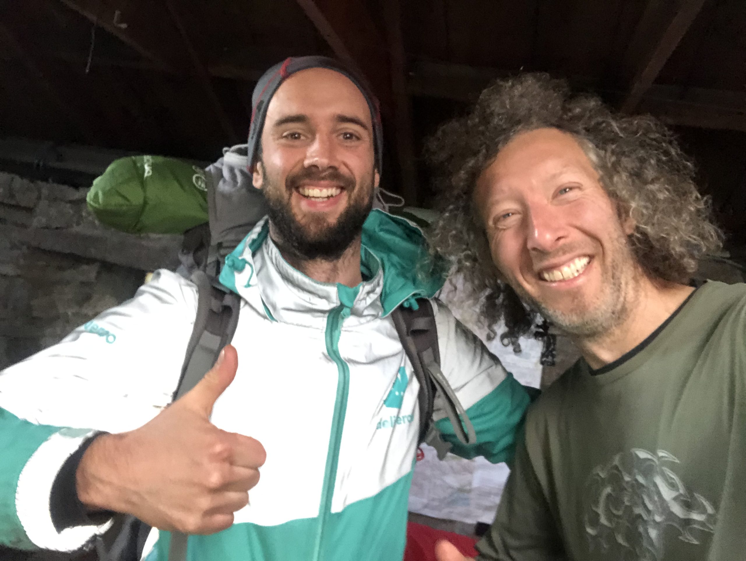
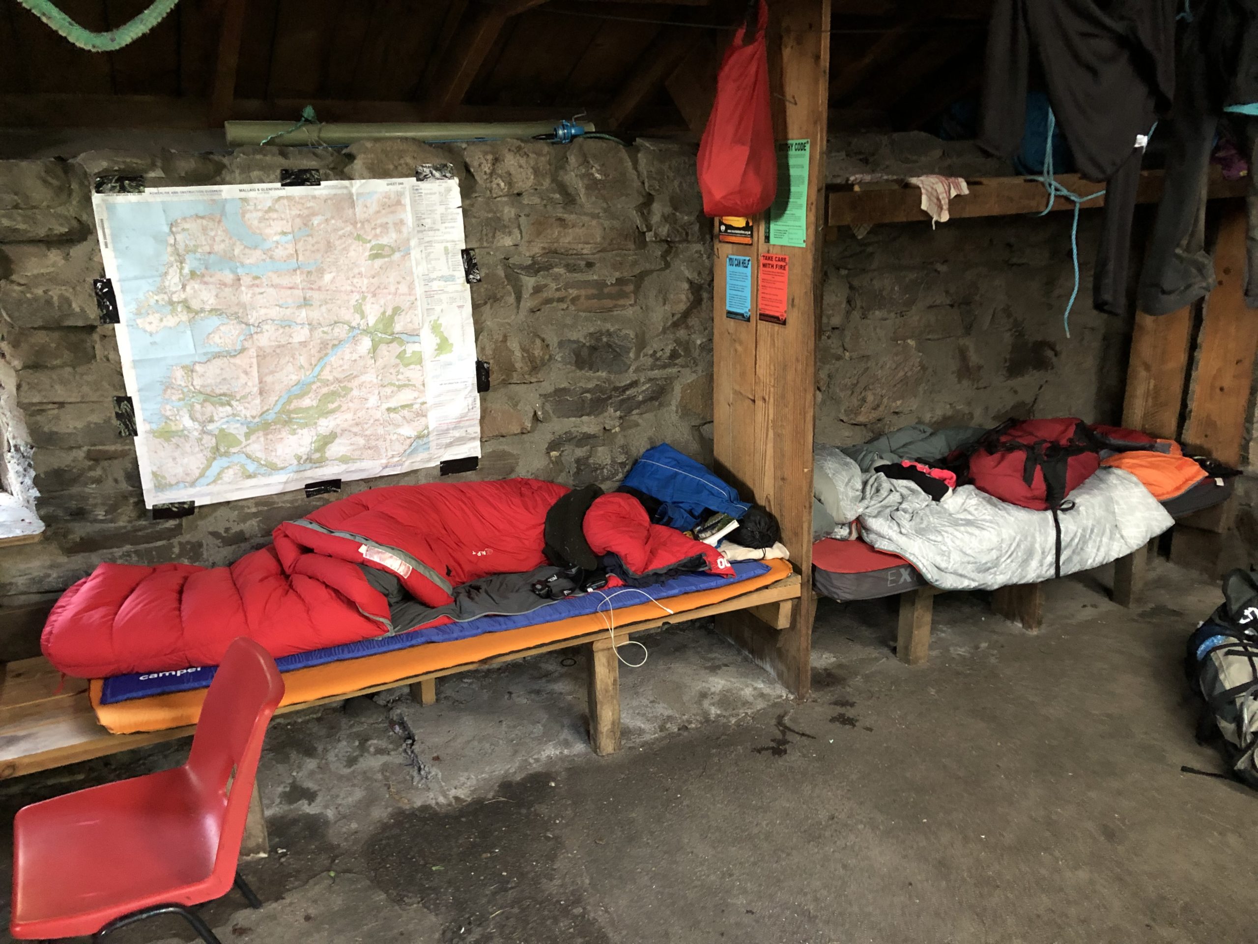
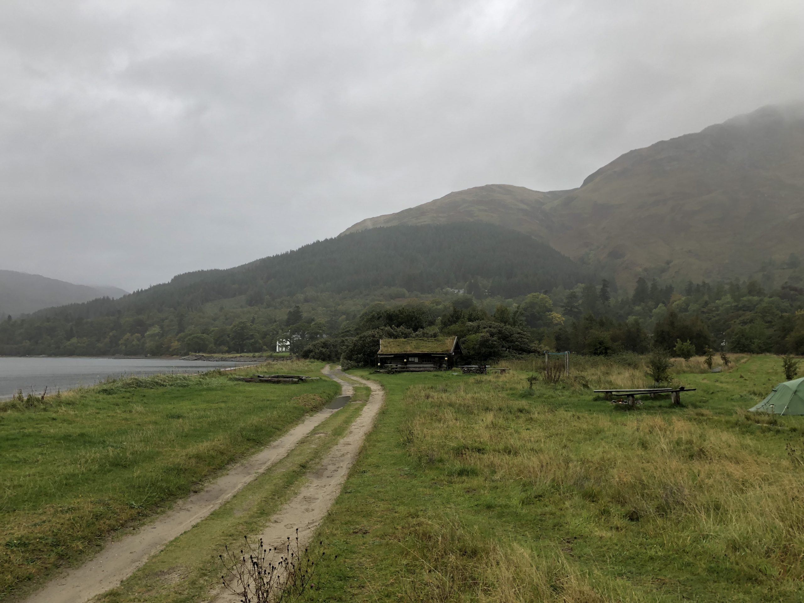
Only 5 minutes after this event, with me(to be honest) looking ever more despondent at the floor, Bronwyn yelped “Look! is that a house? I saw lights!”. This time it was indeed a house! We’d made it! we near-galloped the final yards and entered through the door, after fumbling with its puzzling locking mechanism! I had noticed two tents pitched on the ground outside, but dismissed from my mind the possibility of the place being full up. It turned out to be a fair size bothy – there was ONE free single wooden platform bed, one single platform bed littered with camping stuff and a large platform bed area with someone sleeping on it. The bothy also had endless gas canisters, pots, pans and other camping implements sitting in disarray on a large table in one of the corners.
Chivalrously I donated the free bed to Bronwyn, as she was, for some reason, adamant about going to sleep ASAP. She asked me where I was going to sleep, I replied I’d sleep on the floor if it came to it, I had not trekked all this way and gotten my beloved hiking shoes/socks soaked to bits to sleep outside no matter what! Anyway, it turned out there was only one guy in the room and he’d spread his stuff all over the other spare bed – just as I would’ve done in his situation. Unfortunately, we had to wake him up and ask him if we could move his stuff. It turned out he was a rather nice chap called Alberto from Spain, which I wrongly guessed as France from his accent and which he wasn’t too happy with, but I really didn’t care at this particular moment. He was very kind and gave me a desperately needed cup of water for which I was most grateful. Bronwyn promptly un-rolled her sleeping bag & mat, went straight to bed and fell asleep.
I checked my phone and the time on the clock was 10:55pm!! Now in extreme situations like this, most people sensibly just want to rest or go to bed and sleep, but oddly I tend to “wake up”. Last time was either when I’d queued up from 6am for Wimbledon tennis or after running the Stockholm Marathon. Both times, everyone else wanted to go to bed, but I wanted a few beers and the same was true now!
A Beer with the Deer
I unzipped my backpack, grabbed the tin of Tennant’s beer I suddenly remembered I’d been carrying all this way, went outside and happily drank it for the next half an hour or so under the stars. Must admit realising I’d lugged a heavy can of beer so far was a major incentive to drink it. Shining my head torch around the area I saw several deer standing about 30 yards ahead of the tents. I assumed there must be a large forest in front of us and the deer were just hanging out eating some grass. I’d have liked to investigate further, but really didn’t fancy wandering over there and being attacked by a stag or two. I could also hear waterfalls behind the bothy, but no idea where or how to get to them,. There was no water tap by this bothy, so the waterfalls were where you’d get some fresh water, but the couple of times I tried to get to them I found dead-ends and didn’t fancy climbing over or under anything in these conditions.
Checking the GPS route app I discovered we’d covered about 10.5miles! so nearly 11 hours since we’d left and 10.5miles walked, with full-backpacks! I wondered that perhaps I really should’ve joined the army when I was younger as I always said. I went back in, had the last drop of water from my cup and went to bed.
The Next Morning
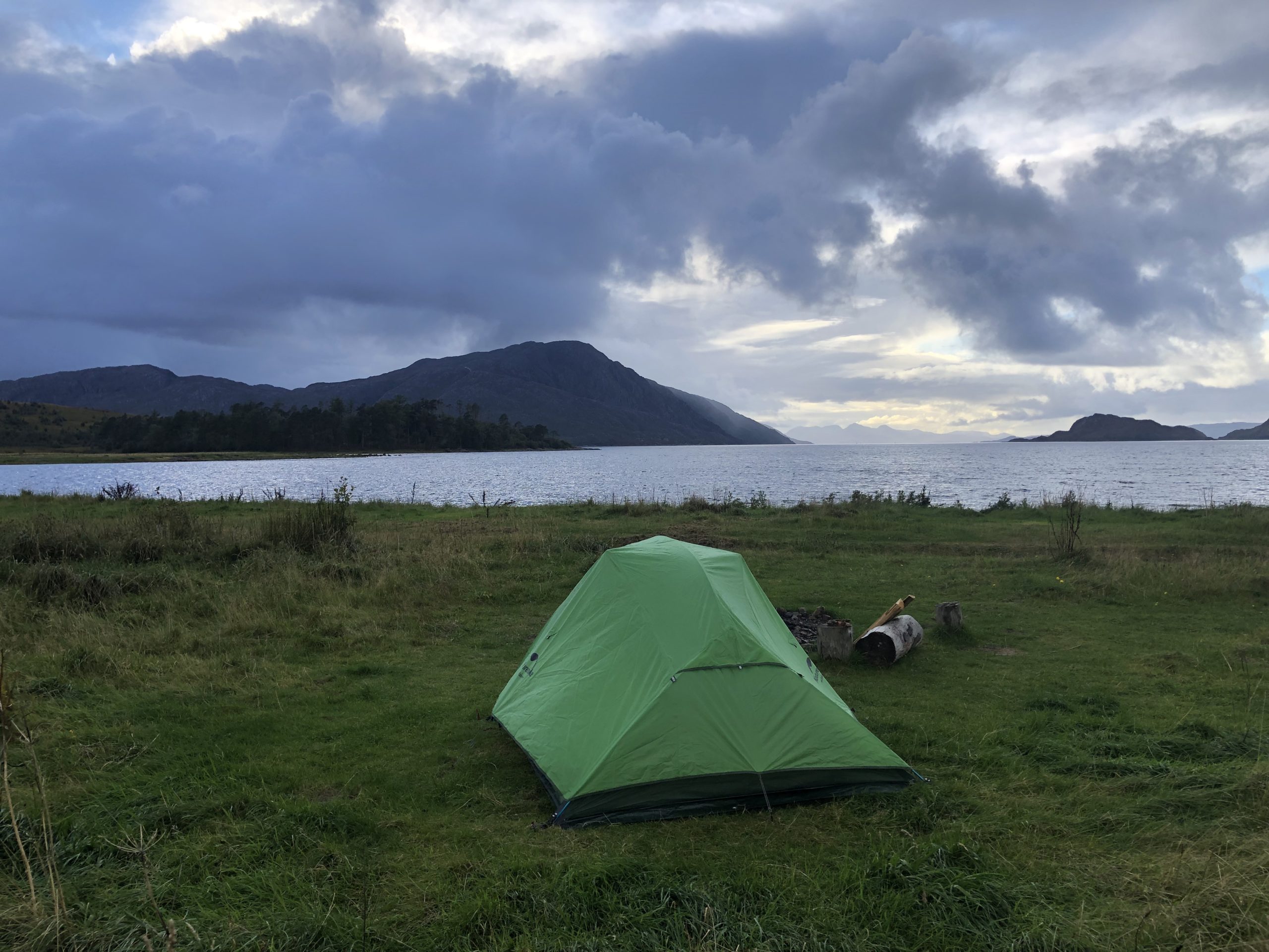
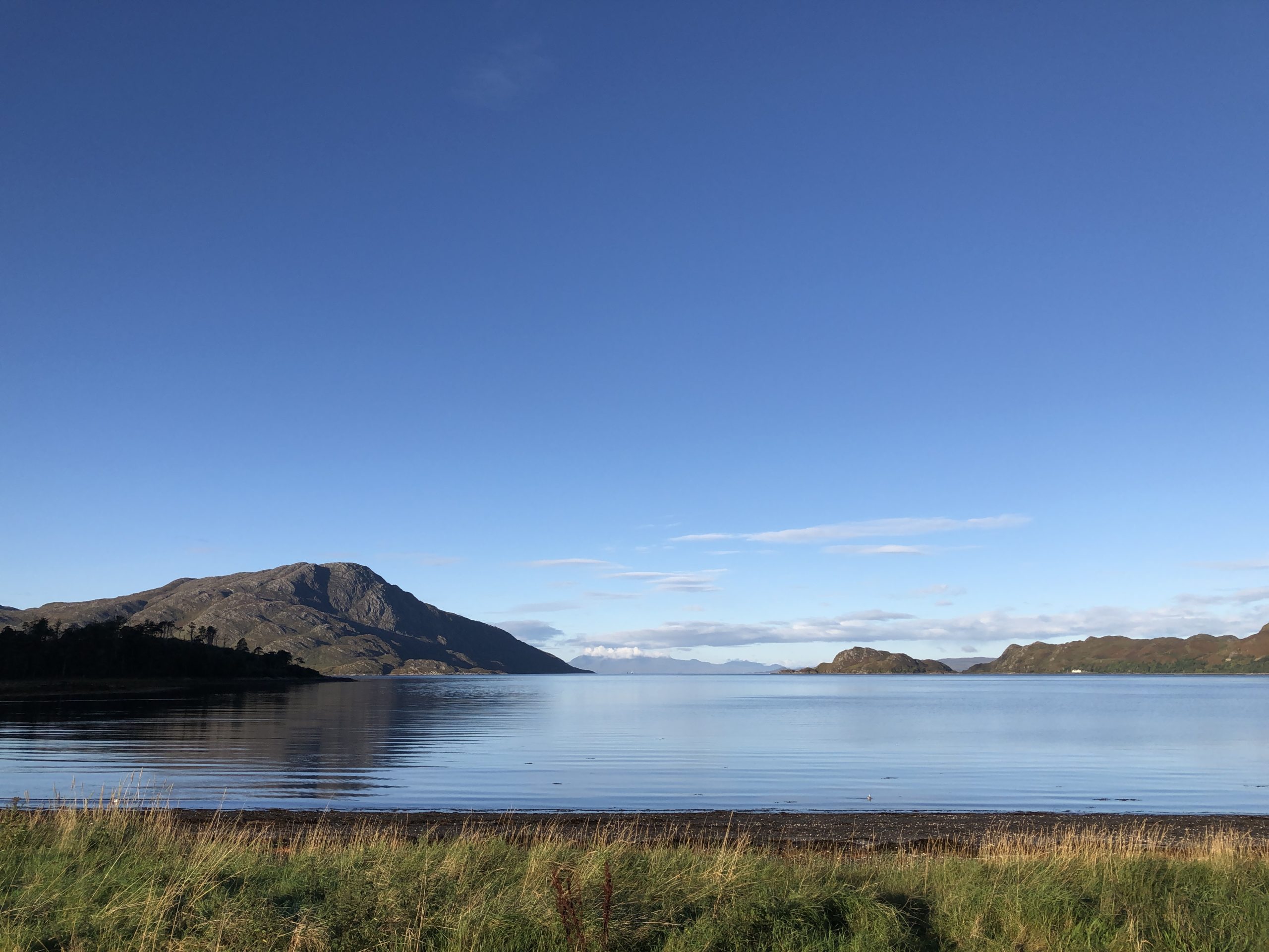
I slept remarkably well on that wooden slat bed in that bothy, I’d have taken it home if that were possible. After waking up, I got up and decided to go hunting for some water from the waterfalls. Upon stepping outside, I was greeted with a most beautiful view! There wasn’t a forest, but a large loch of water! the deer seen last night had just been standing on water’s edge, possibly having a drink. It was a wonderful tranquil peaceful scene. If not for the predicted heavy rain this evening, we would’ve loved to have stayed another night in the bothy.
One of the tents contained a couple whom I had brief chat with on the way back from the waterfall, as they were already packing up. I’d actually followed the husband up to the waterfall, but he clearly wasn’t a morning person and wanted to keep himself-to-himself, don’t blame really. His wife though welcomed a chance to say what they’d done. They’d hiked all the way from Glenfinnan the previous day, hiking from 7am – 7pm, which hugely impressed me. They were similarly impressed with my tale of the previous day, judging by the looks on their faces, I was indeed a monumental idiot 😀 Back at the bothy, Alberto was also nearly all-packed up, after consuming his cous-cous breakfast. We had very pleasant chat, he was doing an amazing month-long walk, starting at Fort William and now would be heading North veering off on a side-path, instead of West of back to Inverie.
Leaving At A More Sensible Time
Sad to leave such a picturesque scene, Bronwyn ensured we left at 11am. So what happened on the way back? Well, to cut a long story short – it took us nearly 3 hours to climb back up the steep zig-zag mountain path and 9 hours in total to get back! yep, we saved a whole hour by not getting lost, which still doesn’t make much sense, although we did spend an hour or so cooking lunch on the mountain which was cool and felt very explorer like, so maybe that’s where the time went. I lost a bet that we’d be back by nightfall, as we trudged the last 3 miles in rain.
Interestingly we spotted the couple from the tent up on the zig-zag path, a good hour ahead of us, but never caught them up or saw them again. Also about half-way up we ran into an old guy who’d apparently been in the other tent by the bothy, he was a seasoned hiker whose wife had kindly let him go off for a few days and he’d just been up to bag a far col. He helpfully answered another question we’d had by telling us the reason nobody was staying in the bothies was because of fear of getting COVID. So with this guy, the other tent couple and Alberto – meant we only saw 4 people the entire way back to Inverie!
Moo Surprise
Now, one of the biggest highlights and surprises of this entire trip was crossing the last bit of farmland before the Inverie border. Shortly after closing a large gate behind us, a gigantic hairy bull with gigantic horns in torch light front of us! This animal was seriously the biggest bovine I’ve ever seen! it was bigger than a water buffalo and just what you need to come across in the dark after hiking for 8 hours wearing a full backpack, meaning running away would be severely hampered if he decided to charge! He starred at us for a minute or so and luckily chose to ran off into the forest. That was quite a relief I can tell you, hiking all that way and being impaled by a cow 1.5miles frmo the end would really make this a disaster hike. From then onwards, we proceeded as gingerly and as quietly as possible along the road, trying not to disturb any more local wildlife. Despite this, we encountered yet another family of these giant beasts, only this time I spoke loudly at them and they too ran off, thank goodness. After that we found another gate and made it back safely past the hazardous waterfall area and back to the camp site.
So where did we actually go?
Back at home, having tracked the whole “journey” on GPS meant the area in the wetlands where we got lost could be traced quite easily. It turns out we didn’t actually go that far off the correct track. Simply put, we went a bit too far past where the river meandered, then circled back upon ourselves, miraculously crossing the swamp North-East-wards in the pitch dark back to the correct path. The large confusing rock in front of the loch that blocked our way turned out to be a very large and unusually placed boulder, something we couldn’t have possibly known or guessed would be there beforehand nor is it mentioned anywhere. Perhaps the most confusing and frustrating thing of all was that the total distance from the Inverie camp ground to Sourlies Bothy IS well over the 7 miles as proclaimed by the guide books, it’s way more like 10miles and those guides either find this funny OR don’t bother updating that information as everyone hikes from Sourlies to Inverie and it wouldn’t matter so much doing that.
Lessons learnt from the hike:
Leave earlier than 1pm
Pack lighter if possible.
Download the GPS map on the GPS tracker next time.
Always take an OS map if doing this kind of thing.
Be prepared to stay out the night.
Get to your destination no later than 30mins after sunset.
Important Notes:
The Bothy Bible book says it’s a 7.5mile 4-5 hour hike from Inverie to Sourlies – this is clearly incorrect. I measured it using GPS twice and it is 10miles in length.
It also took us 9 hours to return, stopping an hour for lunch.
Equipment Used on the hike
Have to say am well impressed and well pleased with the equipment we bought and used for the hike.
Here is a list of some of the best of it.
TheFitLife Walking Poles – proved to be excellent walking poles, one of the reviews says they were used by a guy on a Himalayan trek, so they have a good record.
Azarxis Hiking Gaiters – great gaiters, kept my socks dry as best possible, stopped the rain and prevented my legs getting cut/grazed by thorns too.
NatureHike Cloud-Up 3 Man Tent – an Excellent lightweight tent – perfect for TWO people + backpacks. Being “4 Season”, can confirm it withstood near-galeforce winds and pelting rain on our final night at the Inverie camping site. Quite how you’d fit 3 people in it, really do not know, but that’s the running joke with tents isn’t it. Kind of wish had paid the extra £45 for the 20D 4000mm more-waterproof lighter version, but no other regrets. Ours was 210T is 3000mm waterproof version (tent water-proofing is explained very well by this blog entry).
Other Links
David Preston’s Blog about hiking from Glenfinnan to Inverie
Hi there,
Just stumbled across your website and this article. Planning to maybe do this hike in two weeks time ( late October ) and this article fills me with a mix of excitement and nervousness. Very much enjoyed reading this article and will explore your site a bit more I think.
Thanks a lot for your comment Dan, glad you enjoyed the read. Hiking the Knoydart is awesome, here’s wishing you a Great hike.
I walked the other way, and yes, I’d say it’s longer than that guide states. I forgot to turn on my tracker until I just started the climb by the ruins, but even then it was >13km, see:
https://www.alltrails.com/en-gb/explore/recording/afternoon-hike-b3dd760–541
Wonder what time of year you did this though, with it getting dark at that time.